|

 Save time and money by using our booking service.
more details
|
| |
| |

|
|

We charge a nominal fee for proprietors to be included in our directory. This ensures that people who promote their accommodation with us actively welcome and specifically cater for the needs of walkers. The accommodation details contained within the guide are constantly updated.
Last Updated:
19th April 2024
|
|
|
|
|
|

|
|


|
|
|
|
Pennine Way (British Walking Guide)
|
by Chris Scott, Keith Carter, Edward de la Billi�re
Published:
2009
Binding: Paperback, 272 Pages
Dimensions: 180 mm x 120 mm
Weight:
270 grams
|
RRP:
�11.99

|
| |
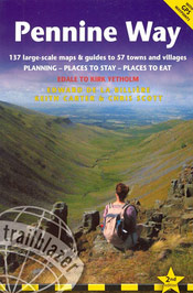 The Pennine Way, Britain�s best-known National Trail, winds for 256 miles (412km) over wild moorland and through quiet dales following the backbone of northern England. Crossing three national parks � the Peak District, Yorkshire Dales and Northumberland � this superb footpath showcases Britain�s finest upland scenery, while touching the literary landscape of the Bront� family and Roman history along Hadrian�s Wall.
- Practical information for all budgets � what to see, where to eat, where to stay: B&Bs, hotels, campsites, bunkhouses, bothies, hostels, pubs
- Itineraries for all walkers � whether hiking the entire route or sampling highlights on day walks or short breaks. Detailed public transport information for all access points
- Includes 137 detailed walking maps: the largest-scale maps available � At just under 1:20,000 (8cm or 3 1/8 inches to one mile) these are bigger than even the most detailed walking maps currently available in the shops
- Unique mapping features � walking times, directions, tricky junctions, places to stay, places to eat, points of interest. These are not general-purpose maps but fully edited maps drawn by walkers for walkers
Back to the Books Page |
to top of the Page
|
|